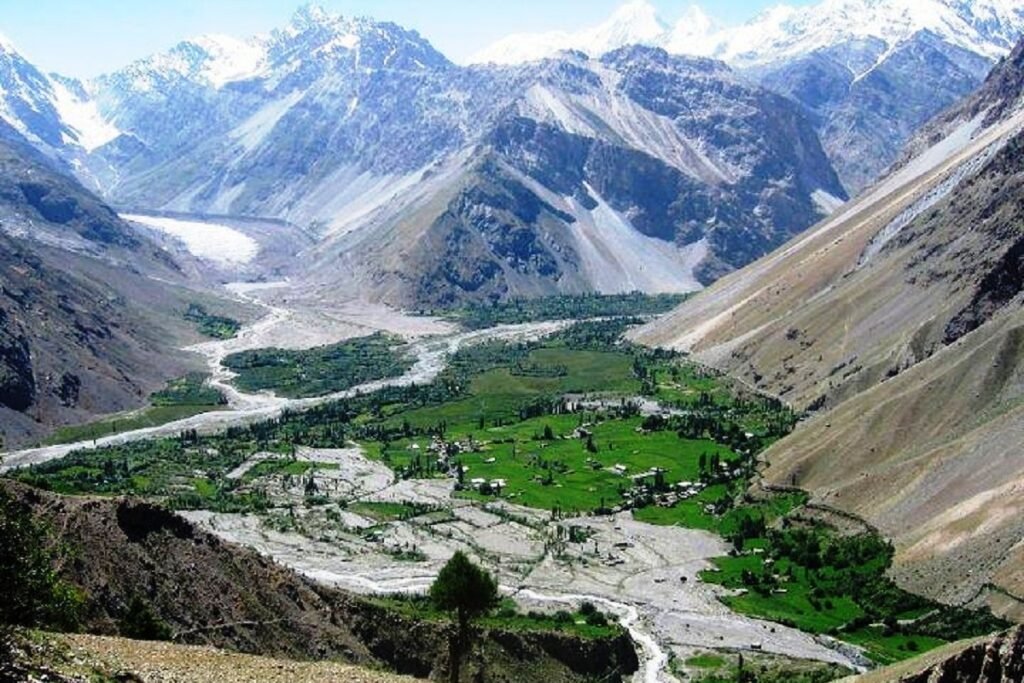
It was in March 1846 that the state of Jammu & Kashmir was founded by Maharaja Gulab Singh after signing the Treaty of Amritsar. Geographically, it was the largest princely State (spread over 2,22,236 square kilometres) that acceded to India in October 1947. In fact, less than half of the state of Maharaja Hari Singh is now with India. Other parts known as Pakistan Occupied Jammu Kashmir (POJK), Chinese Occupied Tibet and Ladakh (COTL) and Gilgit-Baltistan are under illegal occupation of our neighbours.
Of all these territories, Gilgit was one of the strategically most important and British sabotage and intrigue led to its occupation by Pakistan. It was in March 1935 that the British managed to coerce Maharaja Hari Singh to lease the Gilgit area to them for 60 years. Bounded by Karakoram, Hindukush and the Pamirs, it is uniquely placed as it touches Kashmir on the extreme south & NWFP (now known as Khyder Pakhtunkhwa) on the west. Gilgit had come under Indian influence in the period from 1836 to 1842 when Maharaja Gulab Singh’s generals annexed it.
Gilgit fell in the Pakistani lap when a military coup was staged there in November 1947, led by a British officer, Major William Brown who commanded the Gilgit Scouts when the Partition happened. Brigadier Ghansar Singh, who was appointed as Governor of the Gilgit areas in July 1947 by Maharaja Hari Singh, had opposed the retention of any British officers in the state services as he recounted in his small booklet “Gilgit Before 1947’’ years later.
Decades earlier, the British had realised the strategic importance of these areas and tried to make successive Dogra kings part with them. However, Maharaja Gulab Singh’s successors refused to give up control of Gilgit. The initial forays and surveys were made by a British officer Captain Algernon Durand. Captain Durand (later Colonel) was appointed as the first officer of the Gilgit Agency by the Government of India in March 1889. The Durand trio, including Algernon, Sir Mortimer and Sir Edward, experts in Central Asian matters, is well known because the Durand line that demarcates the border between Afghanistan and Pakistan is their legacy.
Early in 1870, the British had assessed that the Gilgit frontier was the place from where Russia could move towards their Indian territories. By 1893, the Gilgit road, 190 miles in length, was opened, mainly to serve British interests though the Dogra kings financed its construction.
By all available indications, Gilgit was essentially a British liability, yet the expenses for its defence were borne by J&K. British efforts to gain control over the Gilgit areas finally fructified in March 1935 on getting its 60-year lease till March 1996. Consequently, J&K’s forces were withdrawn to Bunji, 35 miles short of Gilgit. The river Indus served as a boundary between the British domain and the J&K territory. However, in July 1947, the British handed back the Gilgit Agency to the Maharaja during Partition, though only after hatching a conspiracy to cut it off from the State of J&K, should it accede to India.
As mentioned above, Brigadier Ghansar Singh recounts in his memoirs, written at the age of 95 and first published in 1983, that he was opposed to retaining any British officers, suspecting them of pro-Pakistan leanings. However, he was overruled by the State’s Prime Minister Ram Chandra Kak and told that the Scouts were used to being commanded by the British!
At a critical juncture, the Scouts switched loyalties from the J&K State to Pakistan, arrested the Governor as well as Hindu and Sikh soldiers and raised the Pakistani flag. This entire military coup was prompted, led and executed by Major William Brown. The Pakistan government bestowed on him the Sitara e Imtiaz and he got an OBE (Order of British Empire) from England, obviously for betraying the Maharaja, and handing over Gilgit to Pakistan.
Major Brown’s book “The Gilgit Rebellion’’ gives many details about those events. It also tells us all about his role in the rebellion. Incidentally, new official Indian maps of Union Territories (UTs) of J&K and Ladakh were released in November 2019, after the abrogation of Article 370 and reorganisation of the territory. In these maps, Gilgit-Baltistan are shown as regions of Ladakh.
Brigadier Ghansar Singh wrote that he could sense some days after reaching Gilgit that he was doomed as he had no real powers. Besides, he could not rely on officials who would do his bidding. Recounting his initial days (August 3-4, 1947) at Gilgit, he wrote: I was sitting like a dummy at Gilgit. I had no powers to operate the Budget, no powers of a District Magistrate, no powers to do anything substantial.
The first few days and then six weeks passed off uneventfully: “the civil administration was running most smoothly. His Highness’s birthday (September 23) was approaching and a Durbar was to be held.’’ Various officers, Sikhs, Dogras and Muhammadan gathered at Gilgit in the run-up to this day of celebration.
“Later, I learnt that, during their stay at this very particular time, Muhammadan officers of J&K State Forces contacted Gilgit Scout officers and decided to establish Pakistan in Gilgit,’’ he has recounted. “On the night between 31 October, 1947 and November 1 at 2 AM, about 100 Gilgit Scouts led by Major Brown, Lt Hidar Khan and Subedar Major Babur Khan surrounded my house.’’
Further down, he recounts: ‘It was on 3rd November, 1947 that Lt Col Abdul Majid Khan and Subedar Major Babur Khan came to me. Subedar Major brought one typed telegram, in which they had written: charge of Gilgit was handed over to Gilgit Government…’.
He also writes: ‘I refused to sign the telegram, saying that I had not handed over, but it was forcibly taken over. I was also told that if I wanted all non-Muslims to be slaughtered, I may not sign. Thus I was forced to sign the telegram. Gilgit became Pakistan’.


Add comment