


The genesis of Nepal’s sudden claim to have lost its copy of the Treaty of Sugauli lays in the resumption of bilateral trade between India and China via the Lipulekh Pass, on August 1, 2026. Kathmandu claimed that under the 1816 treaty, Lipulekh, Kalapani, and Limpiyadhura, are Nepalese territory as they are situated east of the Kali River. New Delhi counters that these areas have been under India’s administrative control for decades, and that the border trade with China through Lipulekh dates back to 1954.
Interestingly, Nepal had claimed an inability to find the document in 2016 as well, when the Eminent Persons’ Group on Nepal-India Relations, a joint autonomous group set up to review all bilateral agreements, considered reviewing or modifying the 1950 Treaty of Peace and Friendship. The 1950 treaty settled the reciprocal rights of residence, property, trade, and economic participation for Nepali and Indian citizens. At the time, Kathmandu failed to trace this original document in its records and archives.
In 2019, a Nepalese parliamentary enquiry searched libraries, archives, other repositories, including the Department of Archaeology, Narayanhiti Palace Museum, Ministry of Law, and Ministry of Foreign Affairs, and concluded that the originals of both the Sugauli Treaty and the 1950 Nepal-India treaty could not be located.
The border dispute between India and Nepal exploded in 2020 when India inaugurated an 80-km road connecting Uttarakhand with Lipulekh to pave the way for pilgrims to travel to Kailash Mansarovar. The then Nepal Prime Minister K.P. Sharma Oli fanned popular emotions to dodge pressures from his own party, and unveiled a new political map showing Limpiyadhura, Lipulekh, and Kalapani in Nepal. The map was incorporated into the Nepal Constitution and national emblem.
This is in spite of the fact that four kings of Nepal, viz., Tribhuvan, Mahendra, Birendra, and Gyanendra, never made claims to these areas. However, the tensions resulted in Nepali police firing and killing an Indian citizen and injuring two others at the border in Sitamarhi, Bihar, on June 12, 2020. This was also the time when Chinese forces assaulted Indian troops at Galwan Valley in Ladakh (June 15, 2020), killing an officer and 19 soldiers.
Sugauli Treaty
The Britannica states that under the Treaty, Nepal renounced all claim to the disputed Tarai, and ceded its conquests west of the Kali River and extending to the Sutlej River. Nepal remained independent, but accepted a British resident as an ambassador, not an agent of the colonial state as in Indian Princely States.
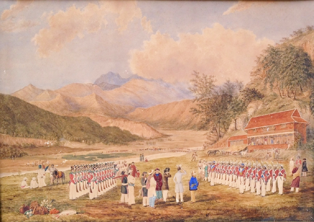
The Treaty of Sugauli between the Kingdom of Nepal and the British East India Company (signed December 2, 1815; ratified March 4, 1816) officially ended the Anglo-Nepalese War (1814–1816) and defined the boundaries of the Himalayan country. The war was triggered by King Prithvi Narayan Shah’s conquest of Kumaon, Garhwal, Sikkim, and parts of the Terai. After some resistance, Nepal accepted the Mechi River as its eastern boundary and the Mahakali River as its western border.
Nepal disputes the 35 sq. km. Kalapani territory at the India–Nepal–China trijunction in Uttarakhand, and 20 sq. km. of Susta in southern Nepal. The Kalapani dispute relates to King Bam Shah’s 1817 query about which headwater stream constitutes the main Kali River.
The Sugauli Treaty led to Nepal losing nearly one-third of its territory to the British East India Company; it also lost a crucial route to Tibet through Kumaon.
Under Article III of the treaty, Nepal ceded to the East India Company in perpetuity, the whole of the lowlands between the Rivers Kali and Rapti; the whole of the low lands (barring Butwal Khas) lying between the Rapti and the Gandak; the whole of the lowlands between the Gandak and Kushaha; all the low lands between the Rivers Mechi and the Teesta; all territories within the hills eastward of the River Mechi including the fort and lands of Nagri and the Pass of Nagarcote leading from Morung into the hills, together with the territory lying between them.
Under Article V, the king of Nepal renounced in perpetuity all claim to or connection with the lands west of the River Kali.
The dispute now concerns where the Kali begins. Nepal claims that the river originates at Limpiyadhura, which would place Limpiyadhura, Kalapani, and Lipulekh inside Nepal.
India asserts that Kali originates from springs below the Lipulekh region. It points to revenue and administrative records to support its claim that Kalapani has historically been administered as part of the Pithoragarh district of undivided Uttar Pradesh, now in Uttarakhand. Both sides invoke British-era maps and records. What is undeniable is that the treaty did not identify Limpiyadhura as the source of the Kali. There is no mutually authenticated map defining any source. Intractable as it appears, only diplomacy can resolve the issue.
References
1] Sugauli Treaty missing? Nepal can’t confirm where 1816 document is amid Lipulekh border row, The Print, August 12, 2026.
2] Nepal claims Indian territory, but can’t find the 210-year-old Sugauli Treaty papers, India Today News Desk, August 13, 2026.
3] Himalayan Blunders, Sandhya Jain, Pioneer, July 7, 2020.
https://www.dailypioneer.com/2020/columnists/himalayan-blunders.html
4] East India Company, Brittanica.
https://www.britannica.com/topic/East-India-Company
5] Full Text of the 1816 Sugauli Treaty: The Agreement That Cost Nepal Two-Thirds of Its Land, Nepal News, January 27, 2025.



Add comment